
PART 4: THE ESTUARY WORLD
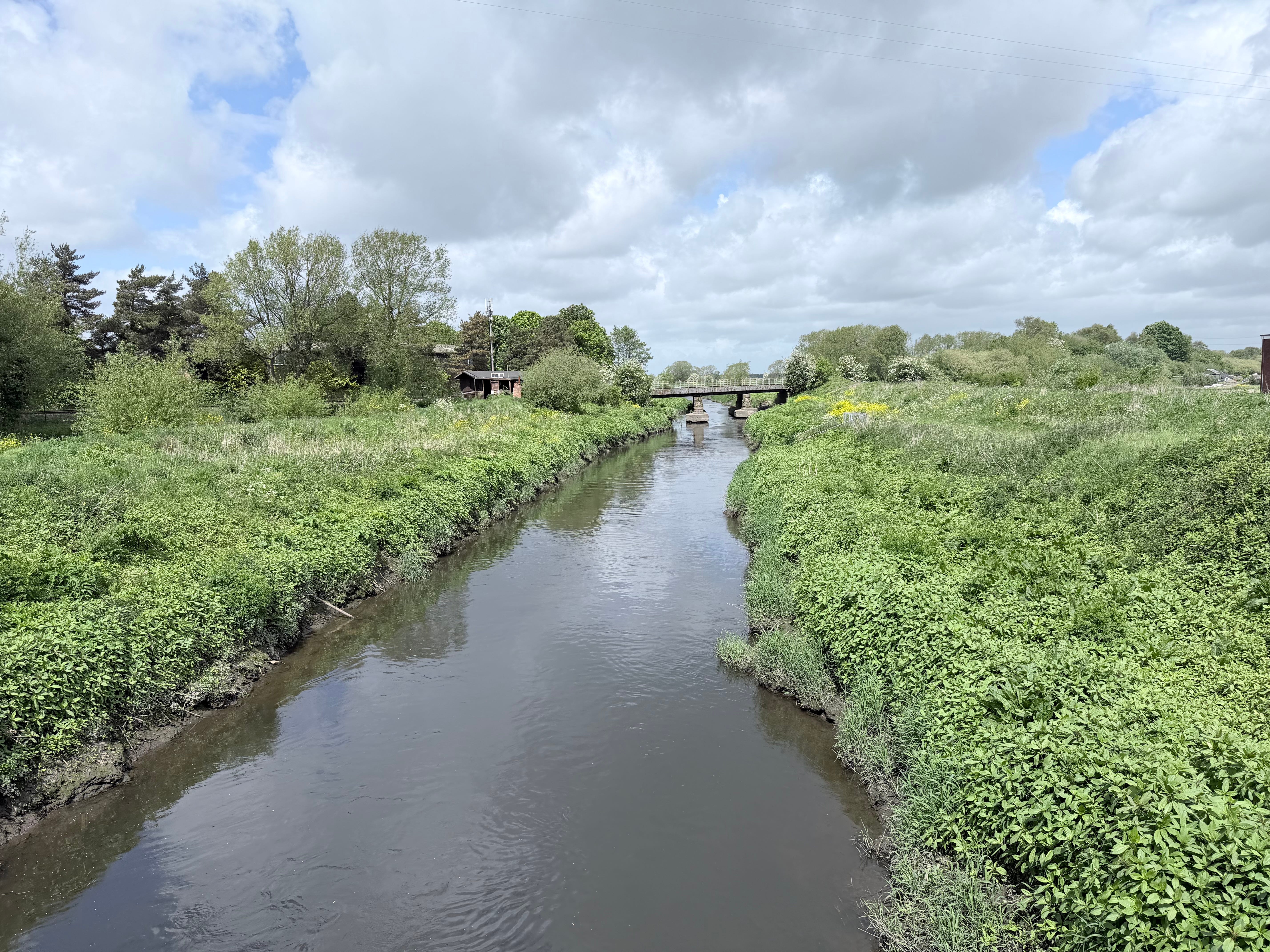
Where the Land Ends: The River Douglas Series
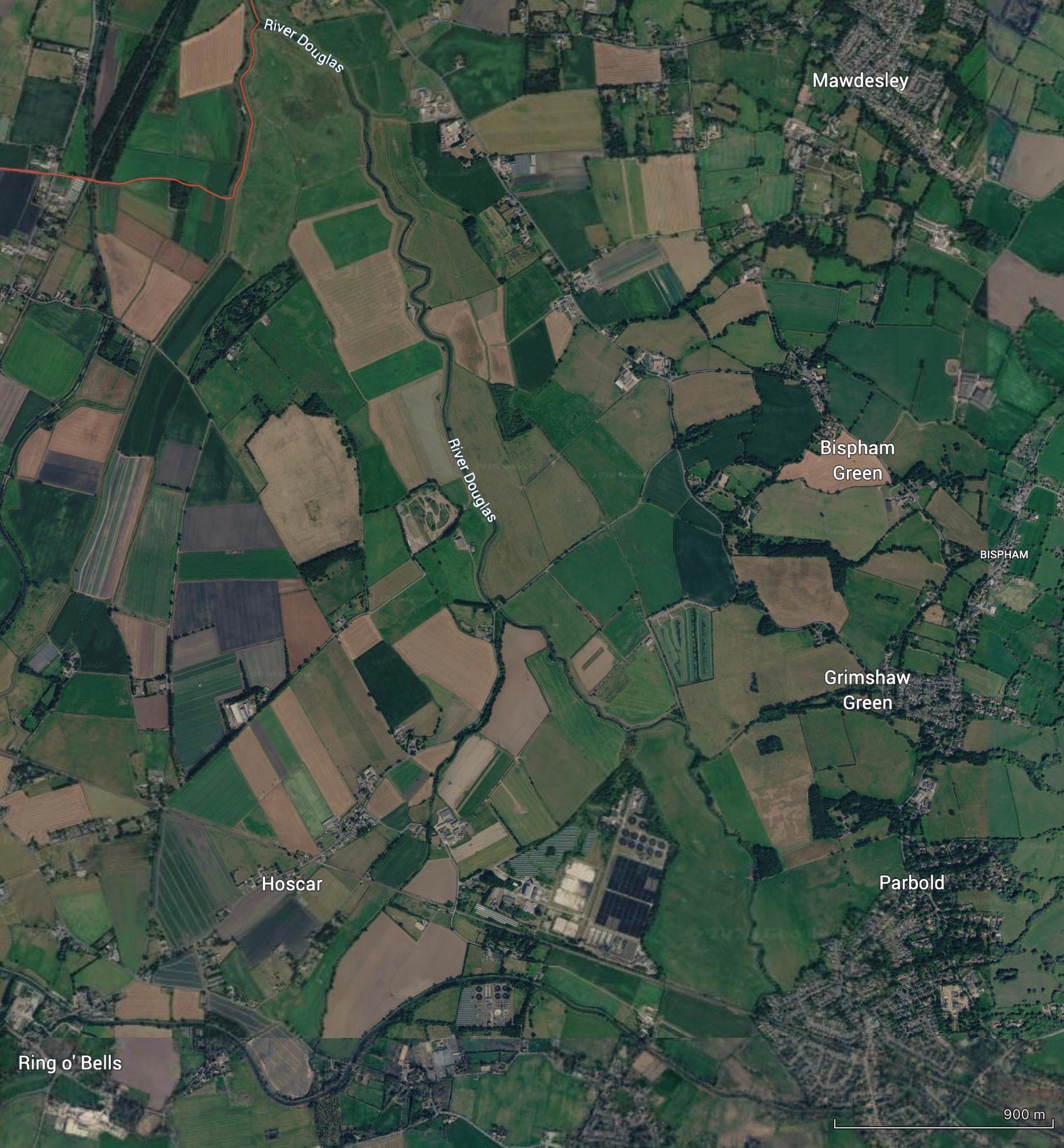
Google Earth Maps: North from Parbold
Follow the river north from Parbold
……………….and something begins to change.
The banks widen.
The air sharpens.
The water slows… and then begins to rise.
You have reached the edge of something larger.
Not quite land. Not quite sea.
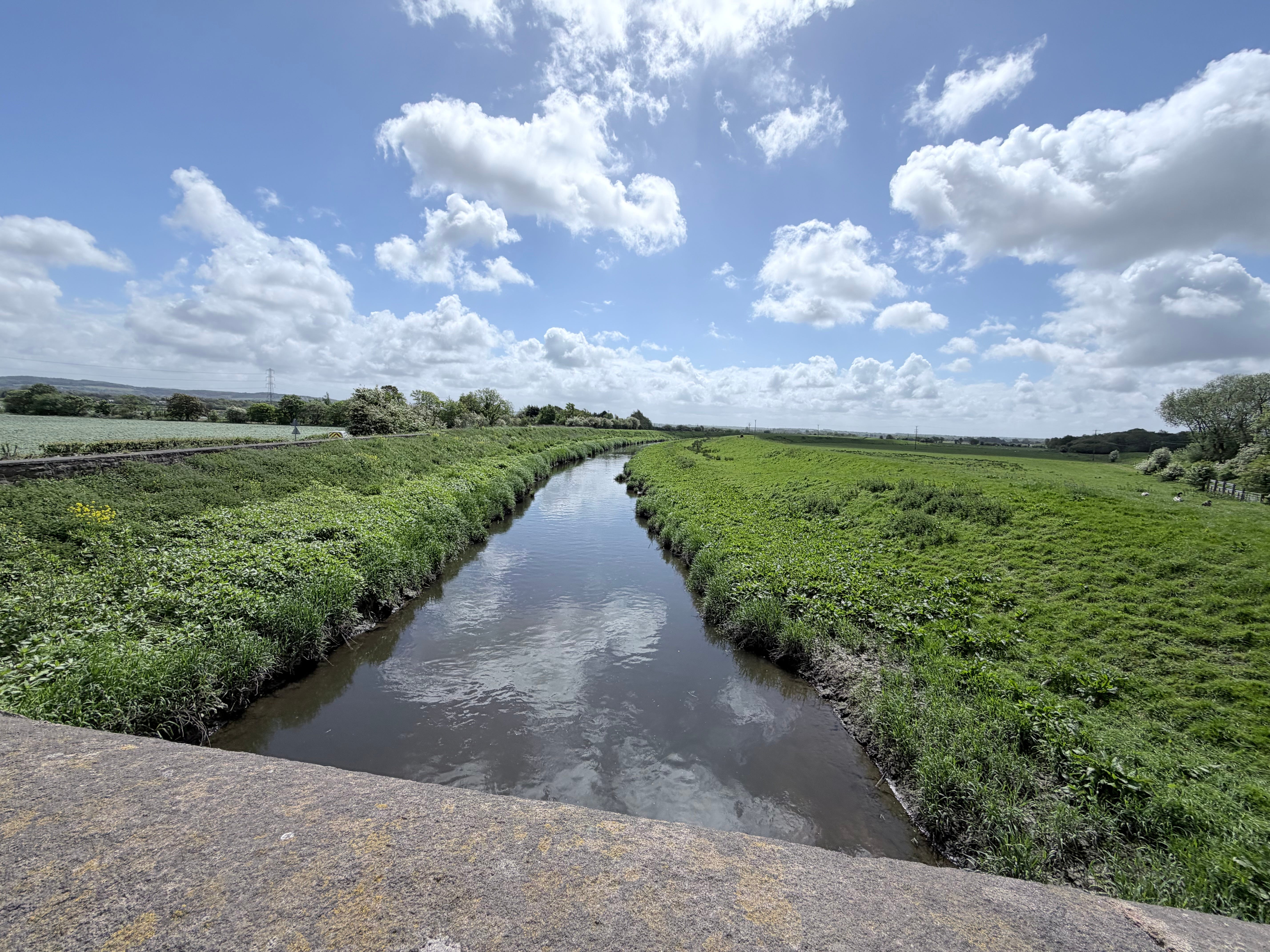
The River Becomes Tide
At Rufford, the River Douglas quietly changes character. The Wham Ditch and Eller Brook converge with the river. And…………………..
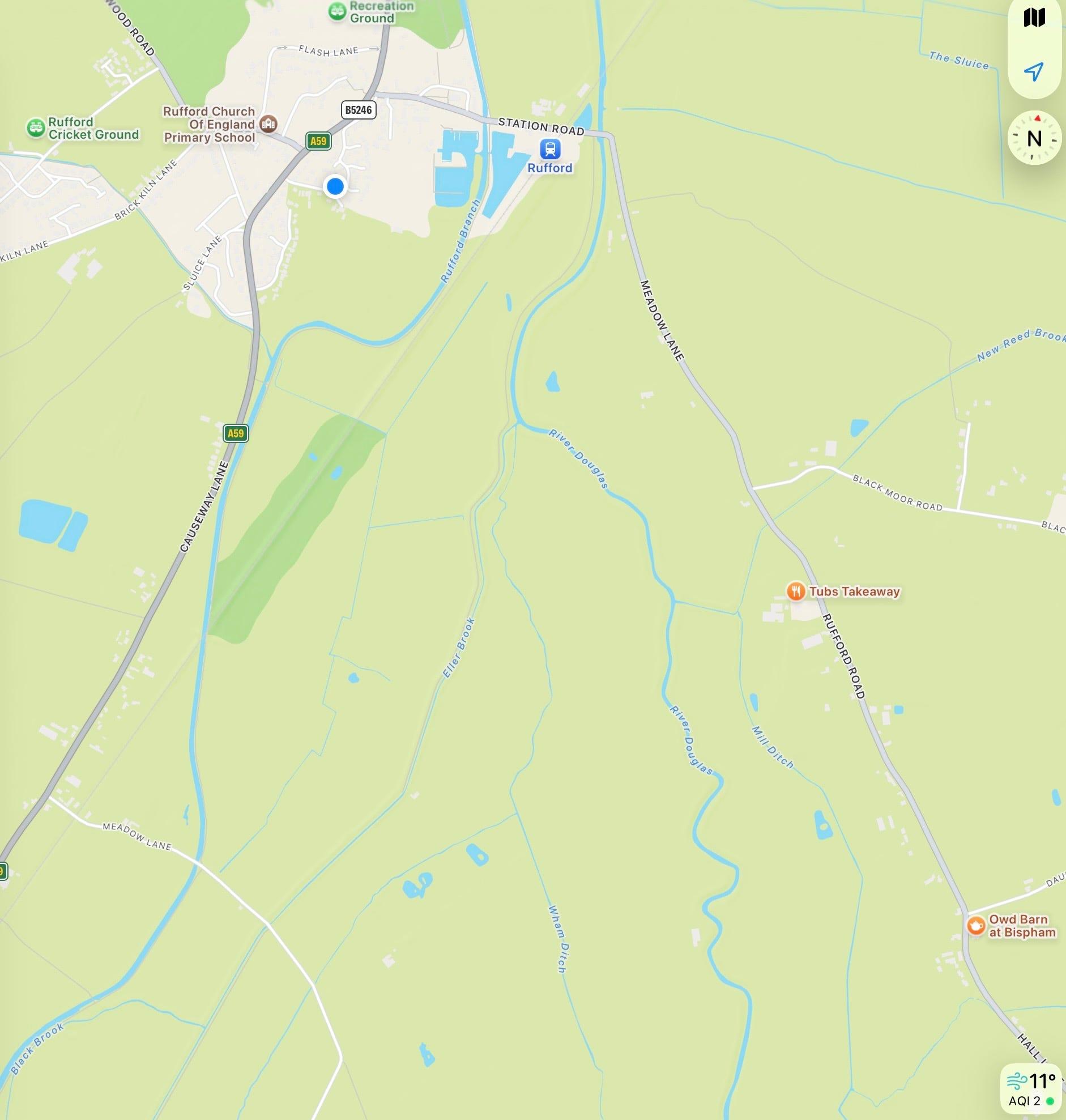
Google Maps: A Convergence
Here is the tidal limit, the point where the river no longer flows only downhill, but answers instead to the pull of the sea.
From this point onward:
water moves both ways
levels rise and fall
the river becomes unpredictable
And just beyond, it meets the wide, shifting waters of the River Ribble.
This is not a place of certainty. It is a place of timing.
A Difficult, Valuable Estuary
The Ribble Estuary has never been easy.
Strong tides.
Shifting sandbanks.
Winds sweeping in from the Irish Sea.
The difference between low tide and high tide can be dramatic, enough to transform the entire landscape in a matter of hours.
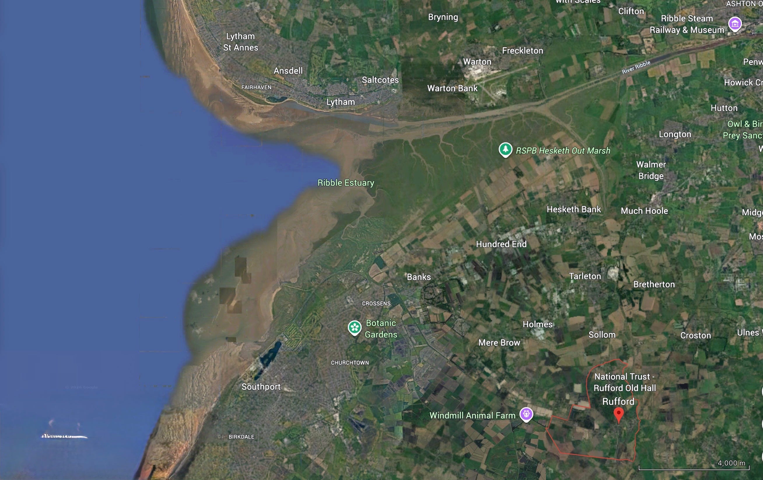
Google Earth Map: Ribble Estuary
And yet, for centuries, people came here.
Not because it was safe. But because it was useful.
Shelter in an Uncertain World
Along this unstable edge, small advantages mattered. At Hesketh Bank and Becconsall, a low ridge of boulder clay rises just enough to provide:
firmer ground
shelter from prevailing winds
a place to land
That was enough, the river here offered something rare; a way to move between inland Lancashire and the open sea.
Even the name Becconsall is thought to recall its role:
a place of beacons, guiding vessels through uncertain water.
The Vikings Knew the Way
Long before formal ports or engineered channels, this estuary was already in use. The Vikings understood landscapes like this. They were not looking for deep harbours. They were looking for:
access
shelter
routes inland
The River Douglas provided all three. A vessel could enter the Ribble, find relative protection, and move inland along the Douglas; reaching deep into what is now West Lancashire.
This was not just a local river. It was part of a much larger network.
Crossing the Sands
Movement here was not limited to boats.
At low tide, it was possible to cross the Ribble itself; from Hesketh Bank to the Fylde coast. This route shortened journeys dramatically. But it came at a cost.
The sands shifted. Channels deepened without warning. The tide returned quickly.
Guides led travellers across - men who knew the land by instinct and experience. Some spent a lifetime doing it. Some never returned. One such guide, James Blundell, drowned in 1844.
His epitaph still speaks plainly:
“Often times I have crossed the sands…”
“…But I was found in Astland drown’d…”
There is no embellishment in those words. Only truth.
The Ferry Routes
Not all crossings were quite so uncertain.
At the end of a quiet lane, still visible today, ferries once operated across the river.
From what is now called Ferry House, travellers could cross toward Longton or Hoole, avoiding long inland detours.
These crossings were part of everyday life:
workers
traders
families
All moving through a landscape shaped by water. And like the ford at Rufford, these ferries reveal the same pattern: Where water interrupts, people create connection.
A Strategic Landscape
Water does not just shape daily life.
It shapes events.
In 1643, during the English Civil War, Royalist forces used these very crossings to their advantage; fording the Ribble ahead of pursuing troops, who were then held back by the returning tide.
The landscape itself became a weapon:
timing mattered
knowledge mattered
water decided outcomes
This was not just geography.
It was strategy.
From River to Port
Over time, the role of this place expanded. What had been:
crossing points
landing places
natural shelters
became something more organised.
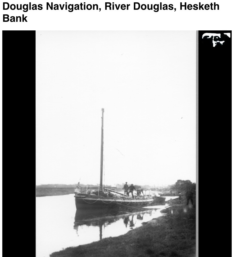
Photo Credit: Red Rose Collections
A working river. Ships began to arrive:
carrying iron
salt
grain
Later, with the development of navigation and canal links, Tarleton became a key transfer point; where inland barges met sea-going vessels. For a time, this was a busy, connected world. A place where Rufford’s quiet inland crossing linked directly to coastal trade.
The Edge of Two Worlds
And yet, for all its activity, this landscape never lost its uncertainty.
It remained:
tidal
shifting
unpredictable
A place between:
land and sea
safety and risk
certainty and change
Standing Here Now
Today, much of that activity has faded.
The ferries are gone.
The guides are gone.
The cargoes have moved elsewhere.
But the landscape itself has not changed as much as we might think.
The tide still rises.
The sands still shift.
The river still meets the sea.
And if you stand here long enough, watching the water move in and out…….you begin to understand something simple.
This was never a fixed place. It was always in motion.
A Final Thought
Upstream, at Rufford, the question was:
Where can we cross?
Here, the question becomes something else entirely:
When can we move?
Because in the estuary world, timing is everything.
“This is where the river stops obeying the land.”
From here on, it answers to the sea.”