
THE RIVER DOUGLAS SERIES
PART 1: THE FORD

Why Here?
Stand on the platform at Rufford Station.
Trains arrive.
Doors open.
People step out…………… and walk into a landscape that feels settled, ordinary, complete.
But nothing about this place is accidental. Because long before the canal and the railway…
someone stood here and asked a simpler question:
Where can we cross?
A River in the Way
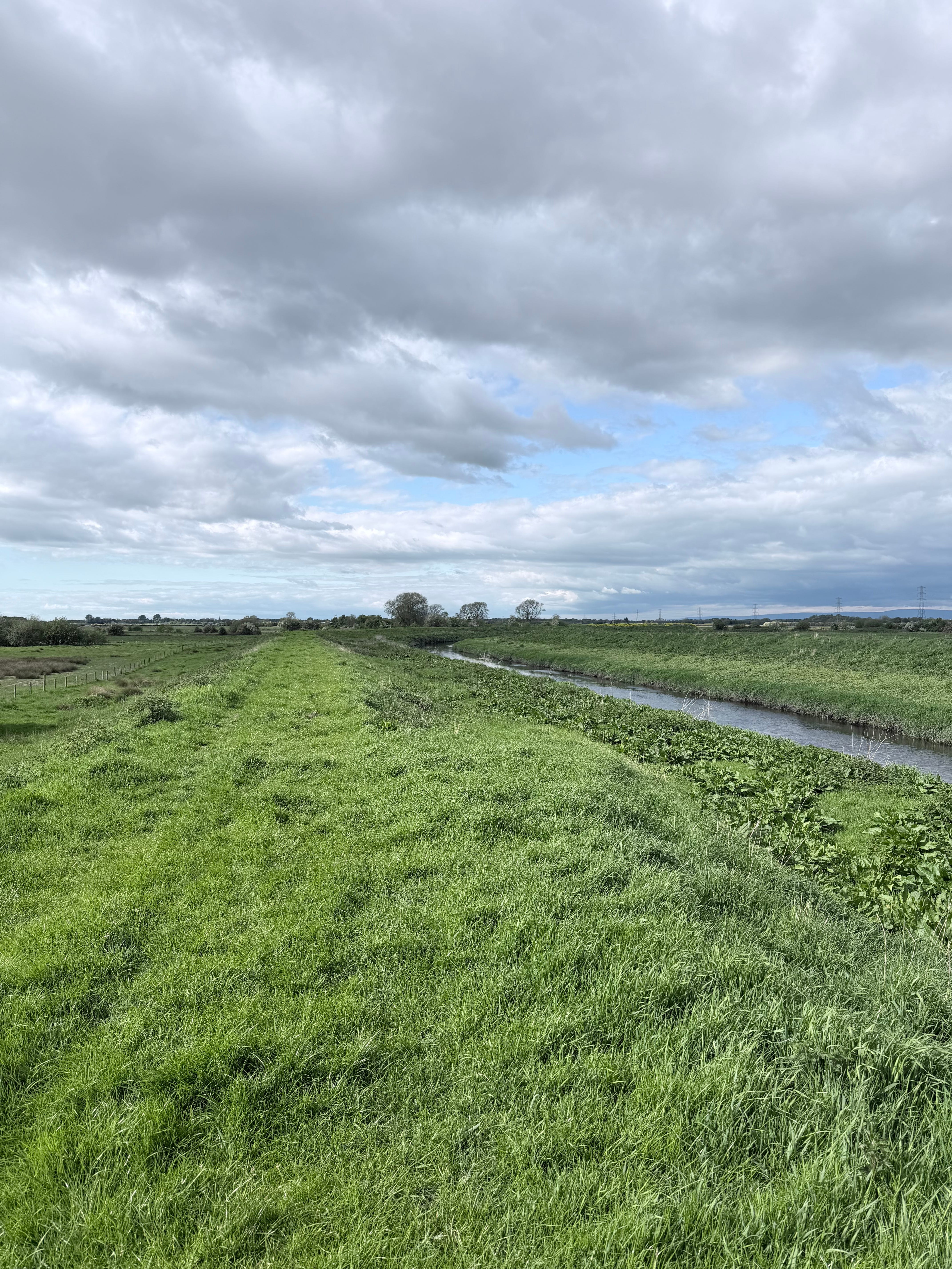
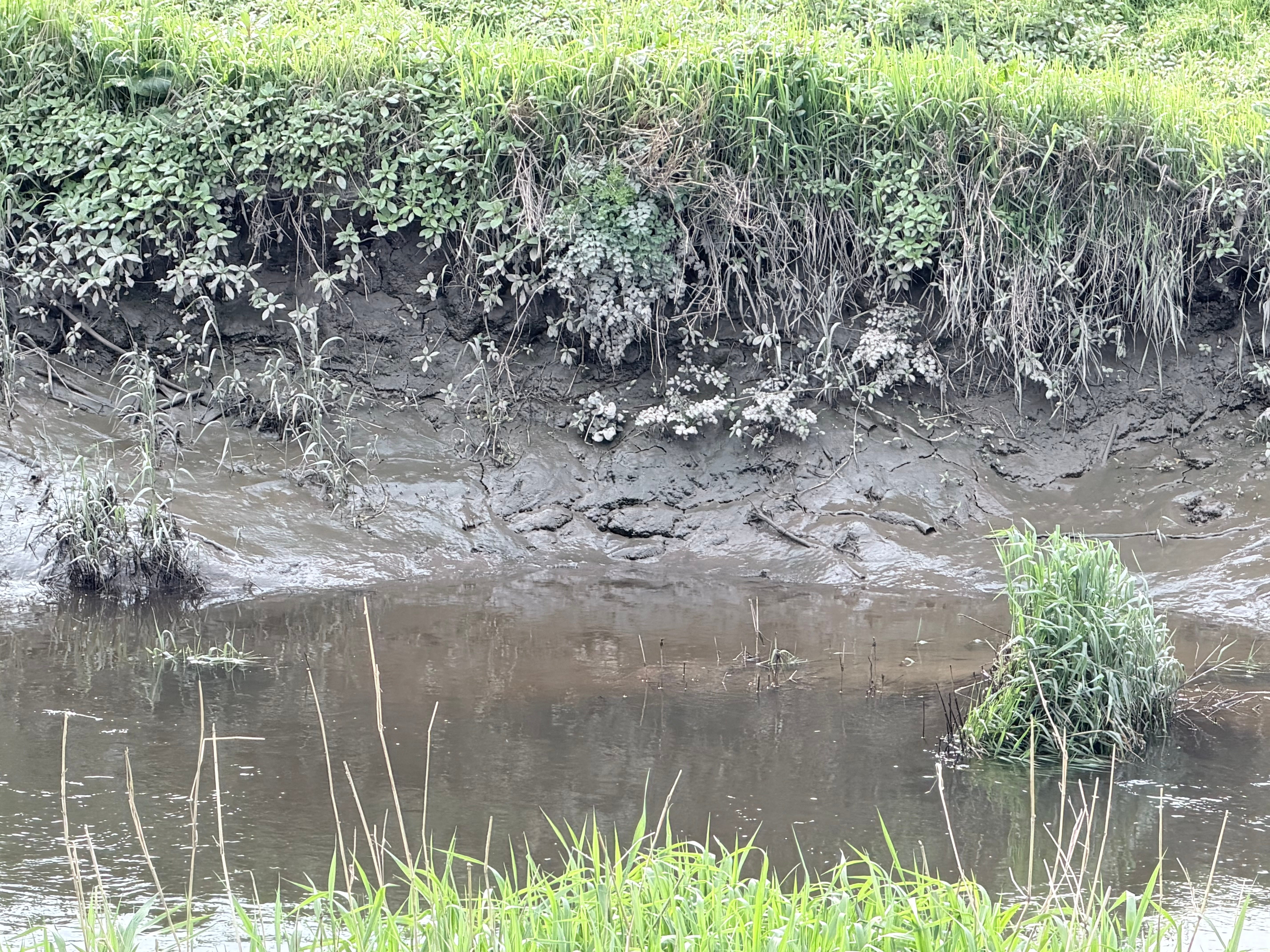
The River Douglas does not look like much as it passes Rufford today. It is slow. Controlled. Almost understated; except when it floods and breaks its banks. More about that as this series unfolds. But once, it was something else.
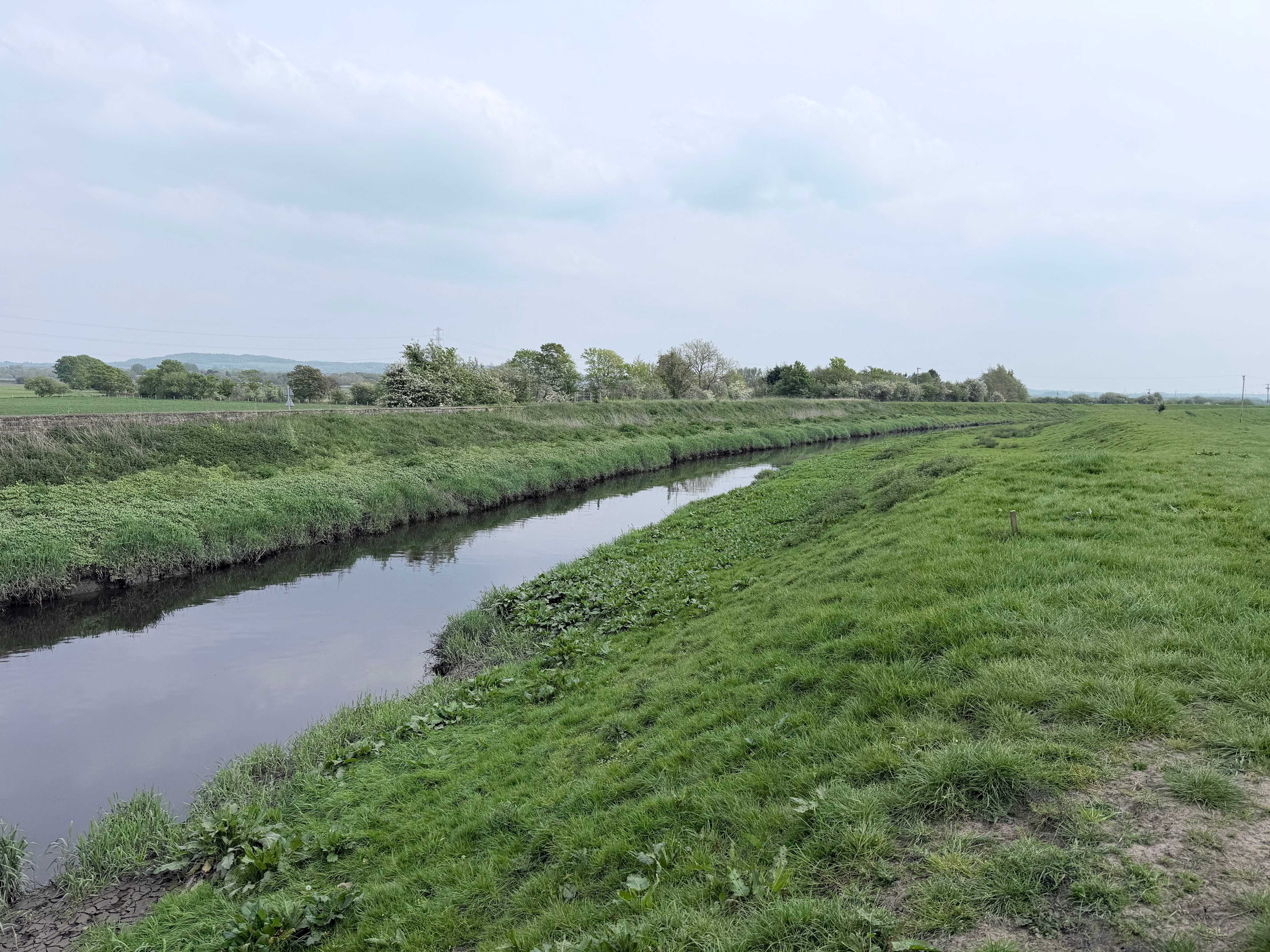
Before embankments and drainage, it spread across the lowland landscape; unpredictable, shifting, and often impassable. There are clearly a series of embankments constructed overtime; at first glance at least 3; however the river underwent significant change as part of the project to build the Rufford Branch Canal. And it was the history of the canal that prompted this series about the River Douglas.
For anyone travelling across West Lancashire, it presented a simple problem:
You could follow it.
You could avoid it.
Or if you were fortunate you could cross it.
The Meaning of a Name
Rufford is not a poetic name. It is a practical one.
“Ford” is clear enough; a shallow point in a river where people, animals, and carts could pass from one side to the other. But a ford is never random.
It is:
firm underfoot,
shallow enough to cross,
accessible from both sides.
It is, in other words, the best available answer to a difficult question. And once that answer is found…
everything else begins to gather around it.
Before Roads, There Were Routes
There were no roads here in the modern sense. No straight lines. No engineered routes. Instead, there were paths; shaped by use rather than design. They followed the logic of the land; in todays language we would talk about UX versus design; that’s right, the user experience dominated whether it was
slightly higher ground
firmer soil
drier edges of the moss
And crucially…
they converged at crossing points.
The ford at Rufford became one of those points.
A place where movement paused, briefly, before continuing.
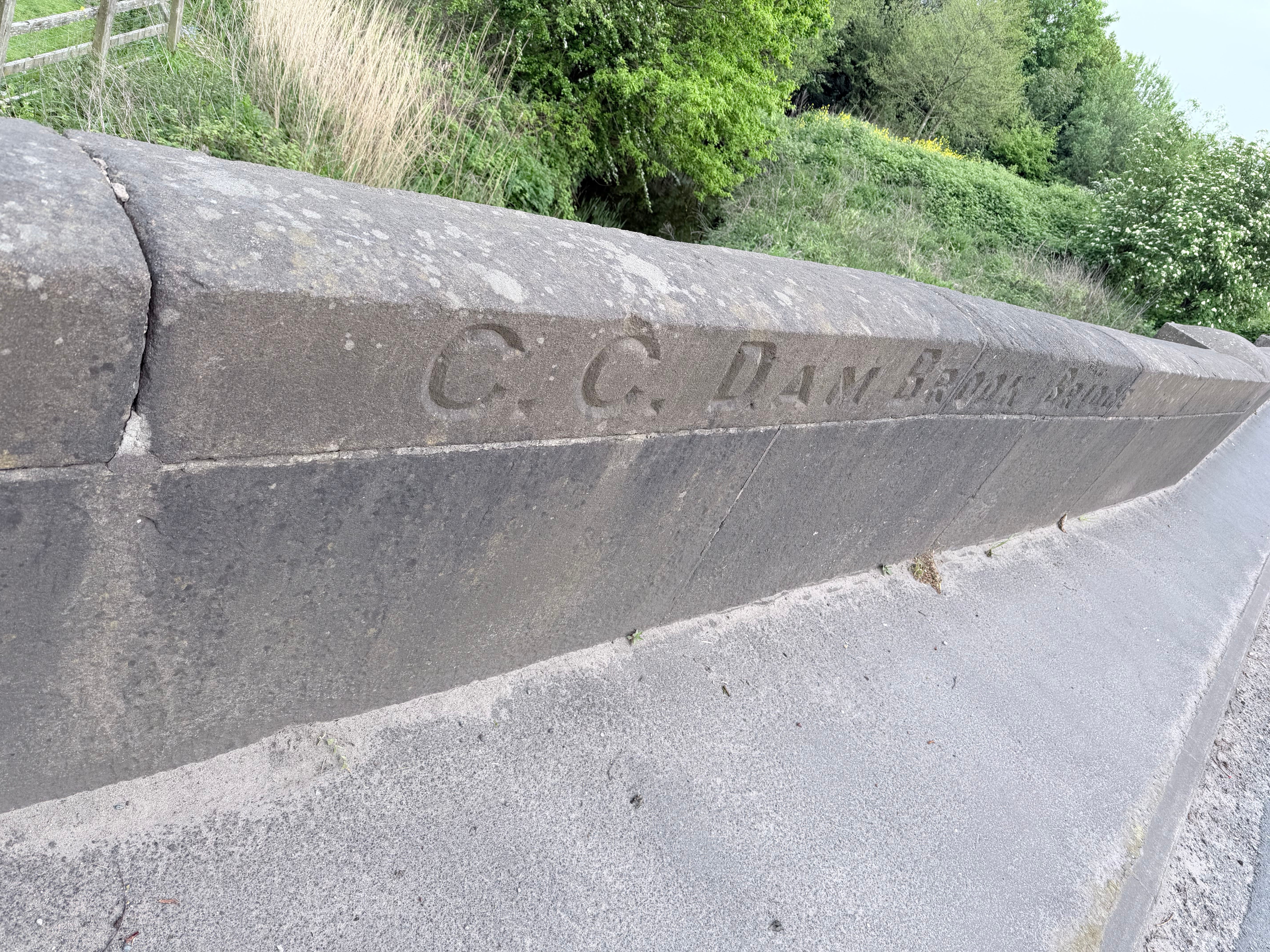
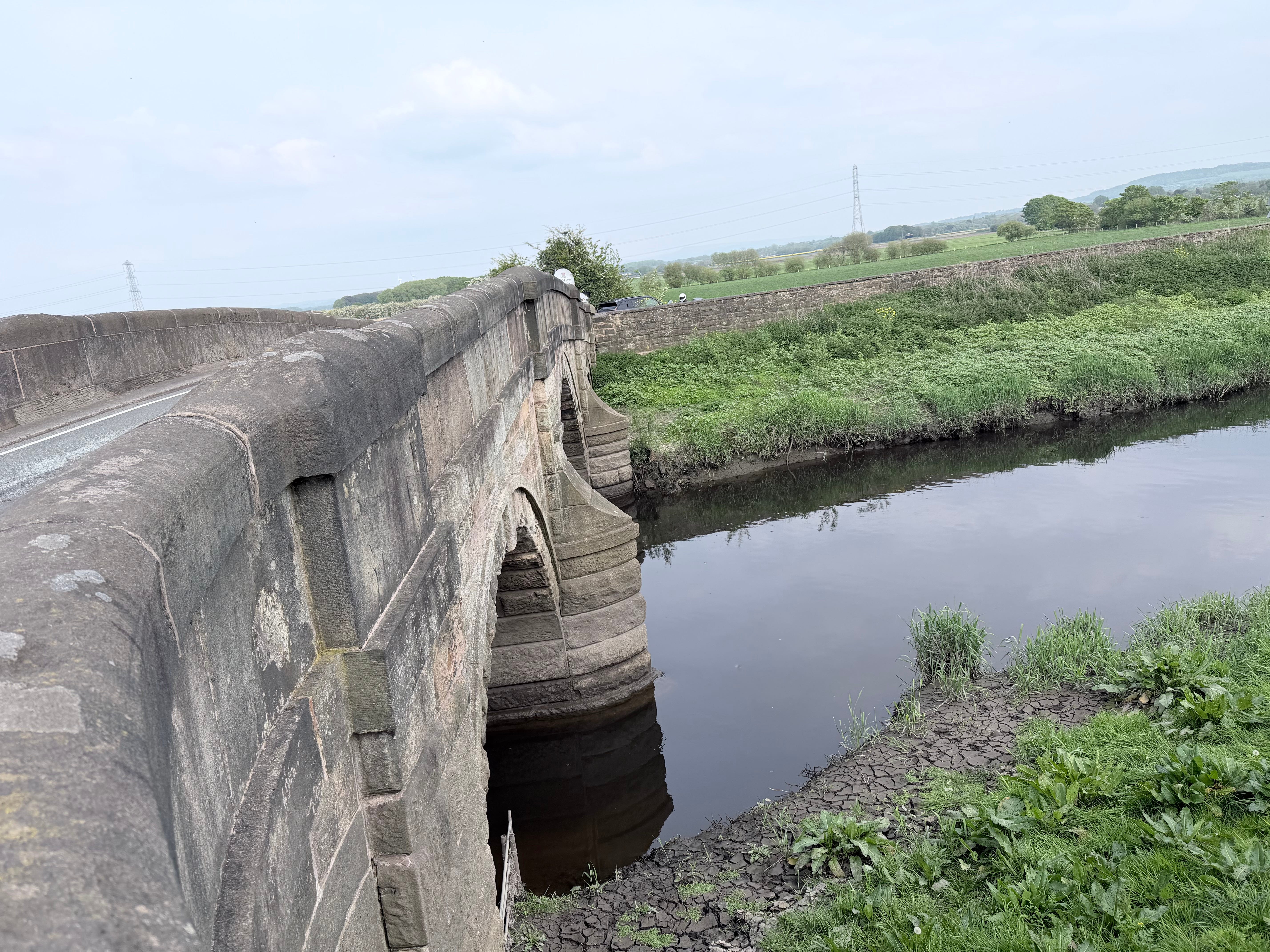
Local discussion has long centred on two possible locations for the ford that gave Rufford its name. The first lies on the road heading south towards Burscough now known as Causeway; perhaps where the Dam Brook Bridge crosses the Sluice.
The second sits just east of the station, where the ancient White Bridge crosses the River Douglas. Personally, I concluded it was most likely where the White Bridge stands today. However, as I walk the River Douglas and its surrounds a new possibility has emerged; more later.
Historical Note: Why Rufford Was Once “Ruch Ford”
The earliest written forms of the village name appear in medieval documents:
1212 — Ruch Ford
1318 — Ruff Ford
1327 — Rughford
1411 — Roghford
Most historians interpret the name as meaning “the rough ford” a difficult crossing point between the waters of Martin Mere and the floodplain of the River Douglas.
However, local farming memory offers another possibility.
Cobble stones have been found along the banks of the Douglas, some 75 yards north of Little Hanging Bridge. These may point to an ancient roadway; perhaps running from Brindle or Brinscall towards the Birkdale marshes, heading west and skirting the edge of Martin Mere. A route used by drovers to move livestock. The bridge at Great Hanging Bridge has strikingly similar architecture to the White Bridge.
Could there have been two fords?
The First Settlements
“The Britons of the Douglas”
Before the arrival of the Romans, the region was inhabited by Brythonic Celtic communities whose territories extended across what is now Lancashire. These early Britons established themselves along the River Douglas, which provided both food and movement through the marshy terrain.
The river ran north toward the Ribble estuary and south toward the higher ground, a natural route through otherwise difficult land. Control of river crossings and higher ground would have been essential.
Even today, the pattern of settlement around Rufford reflects those ancient geographical realities.
“The Romans Pass Through”
When the Romans expanded into northern Britain in the first century AD, they quickly recognised the importance of these river routes.
Forces travelling between their fort at Wigan and the major centre at Ribchester are believed to have moved along the Douglas valley.
Farmers have long spoken of uncovering cobbled tracks close to the river; fragments of movement that hint at something older beneath the surface.
As they travelled north, they would have seen the broad waters of Martin Mere spreading across the lowlands to the west. For travellers, it would have been an unmistakable landmark; a vast inland sheet of water dominating the surrounding countryside.
Where people pass regularly, some begin to stay. Not all at once. Not as a planned village. But gradually -
A crossing becomes a meeting place.
A meeting place becomes a stopping point.
A stopping point becomes a settlement. By the medieval period, Rufford had begun to take shape:
clustered near stable ground
close to the crossing
within reach of both land and water
Settlement focused on the drier margins; between river and moss; it was the most workable.
Water and Land: A Constant Balance
To understand Rufford, you have to understand what surrounds it.
This was not solid, reliable ground. It was:
moss
marsh
open water
Martin Mere dominated and once stretched across miles of landscape, a reminder of how dominant water once was. Even beyond the Mere, much of the land remained wet and uncertain. The ford did not exist in isolation.
It existed at the edge of possibility.
A Decision That Lasted
What makes Rufford remarkable is not the ford itself.
It is what followed.
That one decision, here, we can cross, shaped everything that came after:
routes formed
settlement developed
land was worked
connections spread outward
Even today, the pattern remains. Roads still follow those early choices. Fields still reflect older boundaries. The village still sits where crossing was once possible; although the shape of the village dramatically changed when Rufford New Hall was constructed. It often creates confusion - a New Hall versus an Old Hall.
As you walk or drive through Holmeswood, Rufford, Mere Brow, Sollom, Burscough and Tarleton look at the names of the road. There is ‘the Strine’ and ‘the Causeway’ as immediate examples and a confirmation, perhaps, that roads do indeed follow those early choices.
Standing Here Now
Walk through Rufford today and it feels permanent. But it isn’t. It is the result of:
geography
necessity
repeated human decisions
Layered over time. The ford may no longer be visible. But its influence is everywhere. And a Final Thought
Every place has a beginning.
For Rufford, it was not a building. Not a road. Not even a village.
It was a moment.
Someone standing at the edge of water………….and choosing to cross.
Very interesting read Mark, do you think the railway picked that point for the station and then build a bridge over the Douglas to take advantage of the existing ford, enabling traffic from both sides of the river to access the railway?